
Nine-Foot Waves, Less Erosion: How Timing Helped Cape Cod During the September Nor’easter
Published on: October 2, 2026
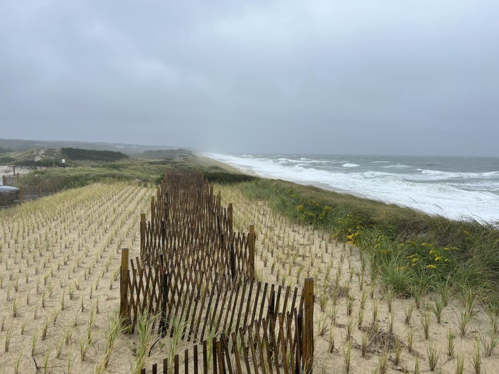
If you watched the waves during the September nor’easter, they looked every bit as dramatic as promised.
Waves reached about nine feet offshore. Wind pushed water toward the coast. High tides were already getting plenty of attention. It looked like Cape Cod could be in for significant erosion.
But widespread erosion never arrived. The reason may have come down to something Cape Codders understand well: timing the tide.
The Storm Surge Arrived at a Helpful Time
Storm surge is the extra water pushed toward the coast by a storm, above what would normally be expected from the tide.
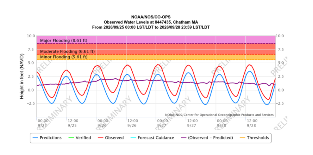
In Chatham, the storm surge peaked at 2.13 feet at 7:42 AM on Saturday, September 26. That happened about an hour after low tide. By the time high tide arrived, the storm surge had dropped by approximately five inches. That still left 1.71 feet of additional storm-driven water at high tide.
Five inches may not sound like a major difference, especially when nearly two feet of additional water remained. But beaches are not vertical walls. They are more like long, shallow ramps. On a gently sloping shoreline, raising the water vertically by a few inches can move the water’s edge much farther horizontally across the beach. That means waves can begin breaking closer to dunes, banks, roads and other vulnerable areas.
The reverse is also true. A five-inch drop in water level can leave more beach between the waves and the base of a dune or coastal bank. That additional space may help absorb some of the wave energy before it reaches the most vulnerable parts of the shoreline.
In this case, those five inches may have helped keep repeated wave action from reaching as far inland. For once, the timing appears to have worked in our favor.
Big Waves Are Only Part of the Story
Nine-foot waves sound like the whole story. They are not.
Coastal erosion and flooding also depend on:
- When the storm surge arrives
- Whether it lines up with high tide
- How long the wind and waves continue
- The direction of the wind
- The condition and shape of the shoreline
If the largest waves, strongest surge and highest tide arrive together, the coast can take a much harder hit. During this storm, those pieces did not line up at their worst levels at the same time.
Someone Still Has to Go Look
Weather maps and buoy readings tell us a lot, but they cannot show every dune, beach, bank or low-lying road across Cape Cod. That is where field observations come in.
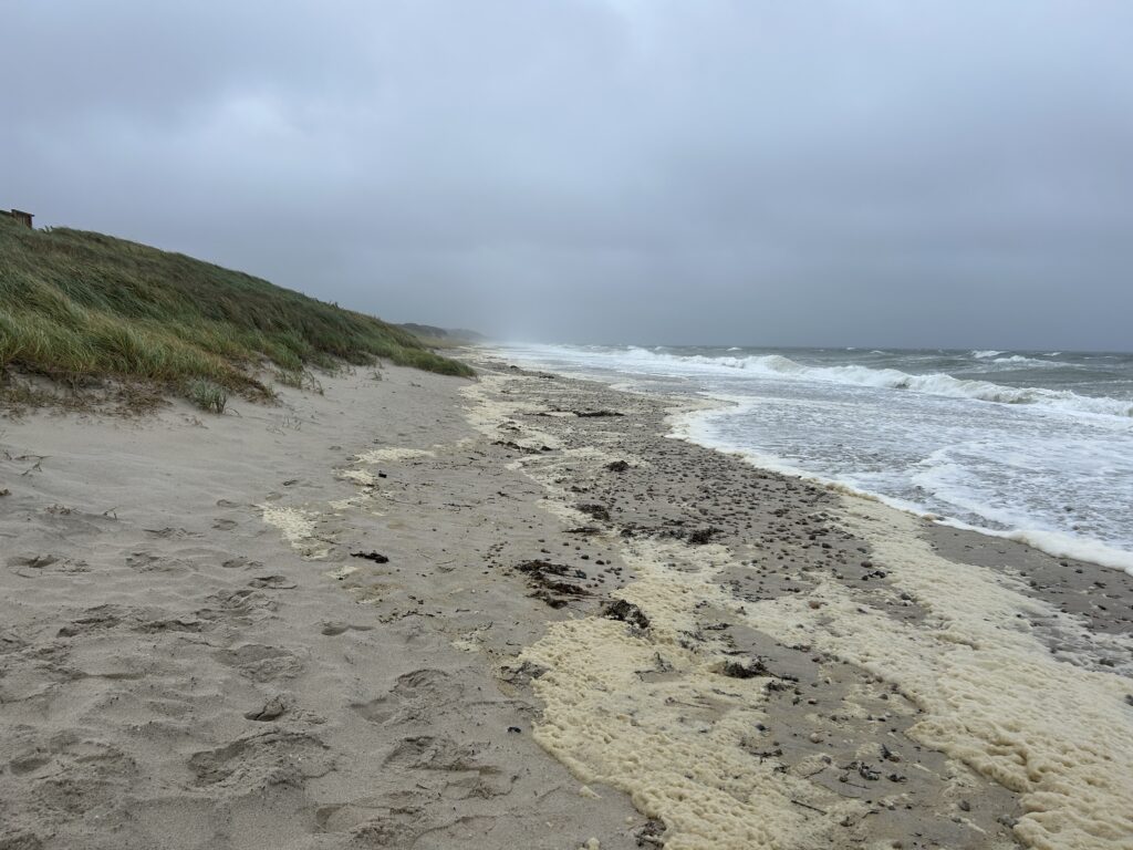
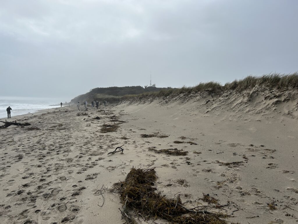
Bryan McCormack works with Barnstable County’s Coastal Processes program, a partnership between Cape Cod Cooperative Extension and WHOI Sea Grant. He spent the storm documenting what was happening along the shoreline. On Saturday, he traveled from Millway Beach in Barnstable to Town Neck Beach in Sandwich. On Sunday, he surveyed locations from Coast Guard Beach to Longnook Beach on the Outer Cape. He returned with more than 300 photos and videos.
That may sound like an unusually large storm photo album, but each image helps create a record of what conditions looked like at a specific place and time.
Why We Track a Storm That Wasn’t as Bad as Expected
A storm does not have to cause major damage to teach us something.
Buoy readings, water levels, tide timing, photos and field observations help us compare what was forecast with what actually happened. That information helps us better understand why one shoreline erodes while another sees little change, or why two storms with similar forecasts can leave different results.
Barnstable County’s Coastal Processes program uses this information to:
- Document erosion and flooding
- Identify vulnerable coastal areas
- Improve our understanding of local shoreline conditions
- Help communities plan for homes, roads and public infrastructure
- Prepare for future coastal storms
The forecast tells us what could happen. The measurements and field observations tell us what actually happened. We need both before the next storm arrives.
Prepare for the Next Coastal Storm
Produced by WHOI Sea Grant and Cape Cod Cooperative Extension, the updated Massachusetts Homeowner’s Handbook to Prepare for Coastal Hazards explains how storms, erosion, flooding and high winds can affect Massachusetts homes. It also includes practical steps residents can take before and after a storm.
Download the free Massachusetts Homeowner’s Handbook to Prepare for Coastal Hazards.
For additional flood, erosion and coastal hazard information, visit the Cape Cod Cooperative Extension Coastal Processes program.
Cape Cod Cooperative Extension: Working for You
Follow Cape Cod Cooperative Extension on Facebook and Instagram for resources, updates, and events.
Learn more about all our programs at capecod.gov/extension..
Legal Disclaimer:
EIN Presswire provides this news content "as is" without warranty of any kind. We do not accept any responsibility or liability for the accuracy, content, images, videos, licenses, completeness, legality, or reliability of the information contained in this article. If you have any complaints or copyright issues related to this article, kindly contact the author above.
